8. Logistics
The Logistics module maintains logistics-related configurations used when warehouse orders are dispatched through available delivery services.
8.1 Overview
The logistics module allows users to view and manage logistics providers, courier services, and postcode mappings available in the CSG system.
This module is mainly used to:
• View available logistics providers • Check courier service configurations • Verify service availability and status • Manage postcode mappings used for shipping allocation • Support order fulfillment and carrier selection
The logistics module includes:
• Logistics Provider • Logistics Service • Postcode
8.2 Logistics Provider
8.2.1 Overview
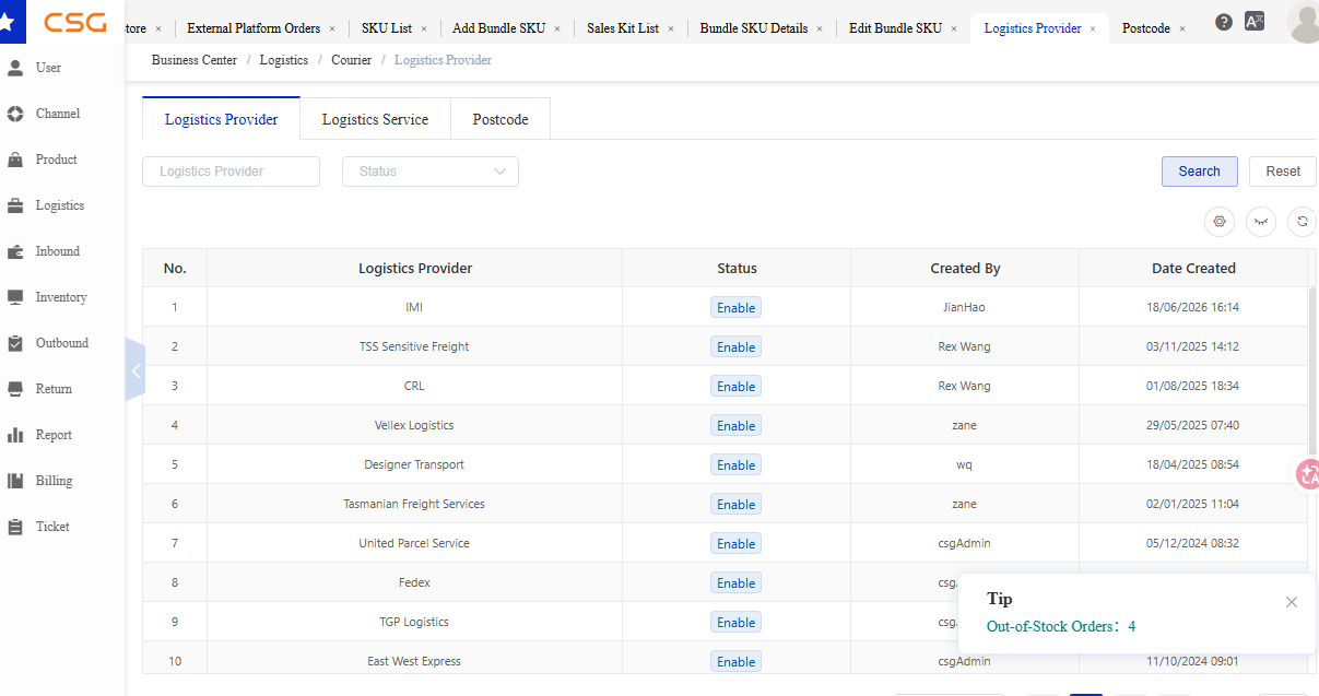
Figure 1. Overview screen from the CSG ERP User Manual.
Navigation
The Logistics Provider page displays all logistics companies configured in the system.
Users can search and view provider information.
8.2.2 Search Filters
Users can search logistics providers by:
| Field | Description |
|---|---|
| Logistics Provider | Logistics company name |
| Status | Provider status |
8.2.3 Logistics Provider Information
The Logistics Provider table displays the following information.
| Column | Description |
|---|---|
| Logistics Provider | Name of the logistics company |
| Status | Provider availability |
| Created By | User who created the provider record |
| Date Created | Record creation date |
8.2.4 Status
| Status | Description |
|---|---|
| Enable | Provider is available for use |
| Disable | Provider is unavailable for selection |
8.3 Logistics Service
8.3.1 Overview
Navigation
The Logistics Service page displays courier services available under each logistics provider.
Users can view service information and verify service availability.
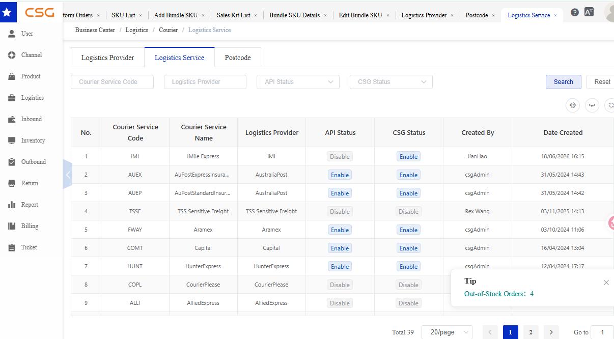
Figure 2. Overview screen from the CSG ERP User Manual.
8.3.2 Search Filters
Users can search courier services by:
| Field | Description |
|---|---|
| Courier Service Code | Service identifier |
| Courier Service Name | Service name |
| Logistics Provider | Related logistics provider |
| API Status | API connection status |
| CSG Status | Service status within CSG |
8.3.3 Logistics Service Information
The Logistics Service table displays the following information.
| Column | Description |
|---|---|
| Courier Service Code | Courier service code |
| Courier Service Name | Courier service name |
| Logistics Provider | Associated logistics provider |
| API Status | Courier API connection status |
| CSG Status | Service status in CSG |
| Date Created | Record creation date |
8.3.4 Service Status
API Status
| Status | Description |
|---|---|
| Connected | API connection is active |
| Disconnected | API connection unavailable |
| Pending | Connection validation in progress |
CSG Status
| Status | Description |
|---|---|
| Enable | Service is available for shipment creation |
| Disable | Service cannot be used |
8.4 Postcode
8.4.1 Overview
Navigation
The Postcode page displays postcode information used for logistics routing and service matching.
Users can search postcode records and verify delivery coverage.
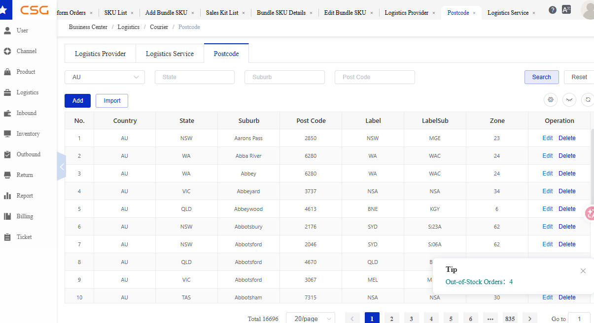
Figure 3. Overview screen from the CSG ERP User Manual.
8.4.2 Postcode Information
Depending on system configuration, postcode records may include:
| Column | Description |
|---|---|
| Postcode | Postal code |
| State | State or region |
| Suburb | Delivery suburb |
| Logistics Provider | Assigned logistics provider |
| Courier Service | Available courier service |
| Status | Record status |
8.4.3 Usage
Postcode mappings are used to:
- Determine delivery coverage
- Match available courier services
- Support shipping rate calculations
- Assist automatic logistics allocation
Source
CSG ERP User Manual, section 8, "Logistics".